Saturday, July 28, 2012

Rocks as Musical Instruments in Eritrea

I don't normally do guest posts, but since I've been busy traveling, and this gentleman's idea was so interesting, I decided to share this from Berhane Meskel Michael - a geologist from Eritrea, East Africa.  I also encouraged him to start his own blog.

ROCKS AS MUSICAL INSTRUMENTS

Who would have imagined rocks can entertain us besides supplying us the mineral resources that are the backbone of the modern economy.
I never imagined rocks can be used as musical instruments until I visited my village in Eritrea. In the village, the Medhanie Alem (Holy Savior) Church has a hanging xylophone made of rocks. The rocks the church used for this purpose include Precambrian basement metavolcanic and metasedimentary rocks. The law of physics requires that the rocks be sufficiently long and flat so that they generate their unique sound when struck, in this case in the village struck by an equidimensional rock.

 
Photo 1. Three long flat slabs of rocks hang on steel wires in the compound of the Medhanie Alem Church. The church is seen in the background.
This local rock bell gets to make its pleasant sound to hear on special occasions like when the Holy Savior Day is observed every October. Its sound closely resembles that of the xylophone.

When struck, waves will be generated that will resonate with frequency. The unique frequencies are governed by the type of mineralogy which in turn controls the type of lithology. Thus, in order to make different sounds, it’s obvious you need to collect different rock types as the Medhanie Alem Church did in Eritrea. So, if you happen to see or hike on dull, massive, structure less rocks, or geologically speaking hornfels and other metamorphic rocks, remember they are capable of more than just storing groundwater, oil, gas, minerals and fossils, they can also entertain us.
MY BIO IN SHORT: My name is Berhane meskel Michael, from Eritrea, east Africa. I’m a geologist just now falling in love with blogging. My geological work experience include working as a geophysicist exploring for groundwater, exploration geologist exploring for gold, copper, zinc and potash from volcanic-hosted massive sulfide prospects to the formidable Danakil Depression. I love to read and write poems, mountaineering, cave spelunking and playing football.
Here is me inside a gypsum cave in the Danakil Depression. It’s amazing I’m inside a hole at 90m below sea level. These caves are a cool shelter from the cruel heat of the day that hovers around 48 degree Celsius in June. 

Thursday, July 26, 2012

Made it to Seattle

Arrived in Seattle today after driving over 4,000 miles across the country (didn't take the shortest route) from the Hudson Valley of New York.

Monday, we toured Craters of the Moon National Monument in central Idaho.  A huge expanse of lava flows formed when this area was over the current Yellowstone hot spot.  We explored a few lava tunnels.


After a stop for the night just across the Idaho/Oregon border, on Tuesday we stopped at the Oregon Trail Interpretive Center near Baker City in eastern Oregon.  It was an excellent museum.  Much of the modern highway we've been following has paralleled the old Oregon Trail.  Imagine traveling in one of these (it's an original wagon that traveled the trail) instead of an air-conditioned car able to drive 75 mph on the Interstate.


North to the Columbia River and down the Columbia River gorge.  We of course stopped at the iconic Multnomah Falls as we neared Portland (and the scenery changed from desert sagebrush to Pacific Northwest forest).


Wednesday, we explored Ape Cave - a lava tunnel on the flanks of Mt St Helens.  It was awsome (my daughter and I braved the upper cave for those of you familiar with the place).  Here are my wife and son who did the easier lower cave.


I also drove up for a look at Mt St Helens from Johnston Ridge (the third time I've seen in in the past 6 years or so - every time it looks slightly different as the central lava dome still grows).


Thursday, we made it to Seattle proper.  After lunch at Pike Place Market, we drove down to the motel in Kent where my workshop will be for the next couple of days (at Highline Community College).

Monday, July 23, 2012

Survived Yellowstone

Still heading toward Seattle from the Hudson Valley on my mega road trip.  We camped a few nights in Yellowstone National Park and then headed down to Jackson, across the Tetons, and into Idaho for a night in a hotel.  Camping again the next couple of nights as we go into Oregon and then Washington for a visit to Mt St Helens.

Lots of geology to write about when I get home.  Here are a couple of pictures.

Old Faithful geyser- the symbol of Yellowstone.


The bison that kept following us on the backcountry trail (they are approaching rutting season which makes the bulls more testy so we were a bit worried for a bit).  He's on the actual trail we had just hiked up and we were in the middle of a large rolling sagebrush grassland.


The Tetons from Mormon Row (old homesteads).  The weather turned a bit in Jackson Hole so we didn't hike.

Friday, July 20, 2012

Blogging and traveling...

OK, so I was nuts to try to blog every day of my road trip.  Can't do it, especially since I'm camping some of the time and out of Internet access.

Since the last post, I've been to the following places in South Datakota - the Badlands, Pine Ridge Indian Reservation, Mammoth Site in Hot Springs, Sylvan Lake, Harney Peak, Jewel Cave, Wind Cave, Mount Rushmore, and the Black Hills area in general.

In Wyoming, we've been to the Bear Lodge Mountains, Devil's Tower, drove across the Powder River Basin, and are now at the base of the Bighorn Mountains.

Everything listed in geologically (and otherwise) interesting and worthy of a blog post.  I was trying to write only about the Badlands last night and found myself staying up to late (we're in a hotel in Buffalo, WY right now).  Got tired and had to go to bed.  Now we're off to Yellowstone with no Internet access.

So, instead of blogging I'm just going to enjoy myself (imagine that) and blog later sometime.  Until then I'll be on sort of a hiatus (with infrequent posts).  I also have an interesting guest post I'll toss up next week.

Until then, enjoy this shot from the top of Harney Peak in the Black Hills...

Tuesday, July 17, 2012

Roadtrip Day 4 - MN to SD

From out campsite at Blue Mounds State Park in Minnesota, it was a half hour ride north to Pipestone National Monument.  It's a worthwhile detour off the Interstate.

Driving into Pipstone, you'll see some large rocks just off the entrance road.  These are the Three Maidens, sacred to the native people who collected the pipestone, and they traditionally left offerings here before quarrying (they still do).  Geologically, they are glacial erratics of granite which were picked up somewhere to the north by the glaciers and dumped here when they melted atop the very different bedrock of Sioux Quartzite.


According to the Pipestone website:

Historically, there were 79 petroglyphs on 35 slabs of rock placed around the three maidens. The carvings depicted various forms such as people, animals, bird tracks, and more. The petroglyphs were removed in 1888 or 1889 after some had been defaced. The stones changed locations many times before some of them were returned to Pipestone National Monument in the mid-1900s. Seventeen of the petroglyphs formerly placed at the Three Maidens are now on display in the Visitor Center.

Here's a picture of one petroglyph on a slab on display at the visitor's center.  Oddly enough, it looks like Anasazi shaman-type images I've seen in Utah.


Here's a partial image from a park sign showing the mining of the pipestone.  C represents the prairie soil which is of varying thickness (looked to be over a foot thick where I saw it).  B represents the hard Sioux Quartzite which has to be removed to access A, the layer of catlinite mined for pipe stones.  At Pipestone, the layer of catlinite is slightly dipping to the east so one must continually quarry deeper and deeper to obtain it.


Geologically, catlinite is a type of argillite - a metamorphosed mudstone.  In this area, 1.7 billion years ago, quartz sands accumulated with occasional influxes of clay mud.  Metamorphism altered the sands into the Sioux Quartzite and mud layers into the catlinite.  The red color in catlinite comes from iron oxides and its fine-grained texture and softness (about as hard as your fingernail) allows it to be easily carved.  Native Americans quickly figured out it could be shaped into pipe bowls and it became highly prized with Indians coming from all over the Midwest to mine and trade it.  Native Americans are still allowed to mine at Pipestone even though it's a national monument.

There were two guys carving the pipestone in the Visitor's Center and it was interesting to talk to them.  The basic technique is simple - the pipestone blanks can be cut with a hacksaw into a rough shape and then rasped down.  Detail work is done with smaller files (ancient people used pieces of flint, deer antler, bone, etc.).  Then it's sanded and beeswax rubbed into it for a glossy finish.


Catlinite was named for George Catlin (1796-1892), the famed artist who specialized in Native American portraits.  Catlin visited Pipestone in 1835 and painted the following scene.  Note the Three Maidens off to the right, the waterfall and cliff line, and the trenching for Pipestone.


It's a bit more overgrown now.  Here's a picture from the cliff face.


More of the cliff face - note the old Indian profile (not intentionally carved).


Here's a modern quarry the Native Americans are using to access the pipestone (it needs to be pumped out of water).


Here's a quarry face the park service prettied up for tourists to visit.  See the thin layer at the base of the cliff face?  That's the pipestone.


Here's a closeup of the pipestone layer.  It may be hard to tell, but it's significantly different looking (and softer) than the overlying Sioux Quartzite.


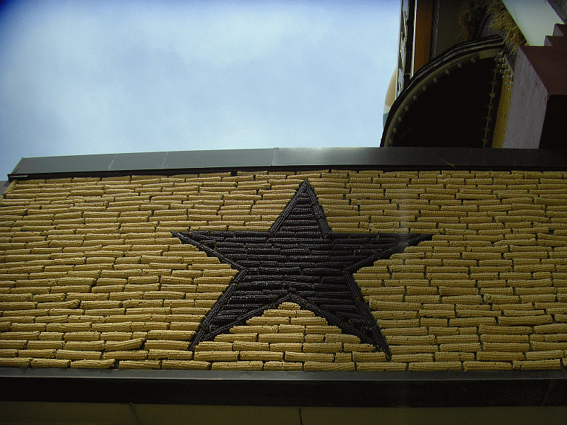
So, after leaving Pipestone, it was a long hard drive through South Dakota to Wall.  On the way, we stopped at Mitchell, home of the world famous corn palace!


 Those murals on the outside of the corn palace (and also inside)... They're made of ears of corn.  Truly one of the wonders of the Western world.


We finally reached Wall, SD around dinnertime.  For those who've never driven I-90 through South Dakota, Wall is the home of Wall Drug.  You can't not stop at Wall Drug when passing through South Dakota (especially with kids).  Free ice water, 5 cent coffee, and millions of trinkets you can buy in dozens of stores (they actually have a very good Western book store too).  Also statues and animatronic T-rex dinosaurs and such to amuse the kids.  I've taken to hugging the bunny every time we stop.


Sunday night was Motel 6 in Wall.  Good thing too, the car thermometer said it was 115 F outside at one point (it was damn hot and I wasn't about to set up a tent in the Badlands!).

Monday, July 16, 2012

Roadtrip Day 3 - WI to MN

We left Madison, WI this morning and followed I-90 north and west to the Mississippi crossing at La Crosse.  I always feel like we're truly out west once we cross the Mississippi even though little changes from WI to MN.

There's not a lot to see driving on I-90 through Minnesota.  Our first stop was the Spam Museum in Austin (we first had a picnic lunch in a nice city park there).  Austin is home of the Hormel company (locals pronounce it "hormull" and, yes, they actually have a small museum dedicated to Spam).

I would never have stopped there but my wife insisted (she likes kitschy stuff) and I have to say it wasn't bad.  I'm not a big fan of Spam but the Hormel company put together a nice little museum to promote their product and even incorporated some humor into it (they had a video running of Monty Python's Spam routine, for example).  It was free, too (although we did get my daughter a Spam tee-shirt).

When we pulled off the Interstate to get gas at Blue Earth, MN (named for the blue clay found along the river), we were surprised by a 55 foot tall statue of the Jolly Green Giant.  Exciting, isn't it?  There's also a museum but we passed on that.  Some more trivia, Blue Earth is the exact middle of Interstate 90.

Eventually, we made it to the western part of Minnesota where we spent the night camping at Blue Mounds State Park (named because weathered outcrops of Sioux Quartzite appeared blue to the early settlers).  Up close it's pinkish to purplish.


The Sioux Quartzite is interesting for a number of reasons.  It's found in western Minnesota and eastern South Dakota and is around 1.7 billion years old (it can't be directly dated but its age can be constrained by upper and lower units and by correlation with similar-age units).  It's a metamorphosed very pure quartz sandstone (parts are conglomeritic) which apparently formed in a braided river channel to shallow marine environment (it formed at the edge of the continent back then).  Cross-bedding and ripple marks are common but it doesn't have fossils.

It's a very hard rock colored various shades of pinks, reds, and purples due to small amounts of oxidized iron and makes an attractive building stone.  Here's an old quarry at Blue Mounds (the entire foreground of the image was quarried out).


Here's a closeup of the block straight in front of the path in the picture above.  It really is an attractive rock.


Another interesting thing about the park is a 1,250 foot line of rocks which have an east-west alignment.  They can be used to show the direction of the rising and setting Sun on the vernal and autumnal equinoxes.  Archaeastronomy alignment?  Native American built?  No one really knows who built it or when it was constructed.  Hard to show in a picture though since they have let prairie grass grow up around the rocks.


The park also has a fenced bison herd, but we didn't see it.  It was a nice place to camp.


Sunday on to South Dakota and the Badlands.

Friday, July 13, 2012

Roadtrip Day 2 - IN to WI

A shorter driving day today as we left Elkhart, IN in the morning and drove to Chicago, IL.  We wanted to stop and see something in Chicago so floated the idea of the Shedd Aquarium, Field Museum, and Lincoln Park Zoo.  My kids love animals and would have liked the aquarium, but it was very expensive so we decided to go to the zoo (which had no admission, just $20 for parking (the museum and aquarium had $20 parking too, but then steep admission prices for all 4 of us on top of that - I'm reluctant to spend $100 for a 2-3 hour stop).

It was a hot 90 degree day so we didn't stay too long but everyone enjoyed the zoo. It was a very nicely set up. I could have done without the hoards of young summer camp kids in color-coordinated tee shirts running around, yelling, and blocking access to stuff.  We obviously took lots of animal pictures (who doesn't at the zoo?) but here are the two I'll put on my blog.


My daughter sitting on a beautifully polished and striated glacial erratic.  Rocks are so much more interesting than animals, don't you think?  Of course my wife took the picture so she focused on my daughter rather than the rock.  My wife also has this annoying habit of trying to take bad pictures of me (any picture of me is typically a bad picture) and you can see the typical result.  Yes, I'm a jerk.

OK, here are some real animal pictures.  A Siberian tiger and a swimming polar bear.  Happy?


I probably would have enjoyed the Field Museum more (I've been there before but it was a number of years ago now) but then we would have stayed later and, as it was, leaving downtown Chicago on a Friday afternoon around 1:00 pm was horrendous traffic-wise.  I'm always amazed at how much of an asshole some people are when they drive - especially in major cities.  I'd rather swim with the polar bear than drive on an expressway in Chicago on a Friday afternoon.  I'd be safer.

Eventually we worked our way up to Madison, WI where we're staying for the night.  It wasn't a bad day but it was filled with a lot of little annoyances - traffic problems, driving through a torrential downpour, car concerns (which I checked out and am pretty sure are nothing to worry about), having to stop at Cabela's outside of Chicago to get camping stuff we didn't have, bad waitress service at dinner when people were starving, and a sub-par hotel in Madison with plumbing problems (Microtel).  It is Friday the 13th (not that I believe in such nonsense).  Have to take it all in stride when traveling.

Hopefully tomorrow is better as we drive up through WI and MN to near the SD border and camp at Blue Mounds State Park.  My wife wants to stop somewhere crazy - I'll write about it tomorrow (or whenever I get Internet).

Thursday, July 12, 2012

Roadtrip Day 1 - NY to IN

So I was accepted to a professional development workshop in late July in Seattle.  Instead of flying out, like a normal person would do, I decided to tell my wife that we were packing up the car, and our two kids, and driving out for a multi-week "vacation".

I do know what I'm getting into since my brother-in-law used to work for Microsoft in Redmond and we've driven cross country numerous times.  I hate flying and I'm a geologist - there's a LOT of interesting stuff to see between the two coasts!  So, we got a housesitter for the dog and cats, packed the car (I don't think we could fit another thing in there), and took off at 7:30 this morning.

So today was the longest mileage driving day - over 700 miles from our home in the Hudson Valley of New York to a hotel in Elkhart, Indiana.  I intentionally scheduled a long drive today since none of us are really interested in enjoying the sights of the Southern Tier of NY and northern Ohio (been there, done that).  Too much like home.  We're anxious for the landscapes of the West.  Good thing about stopping here in Indiana is that tomorrow morning we quickly cross into the CDT time zone and get a free hour!

More interesting information than today's post to come in the days ahead (and pictures).  The only pictures we have of today are the kids playing with the camera in the back seat during the 12+ hour ride.  You don't want to see those!

Monday, July 9, 2012

Road Trip!

Frantically preparing for a big roadtrip out West.  We leave on July 12 and I'll try to write a post for each of the days (can't post every day since some places have no WiFi).  We'll be seeing lots of interesting geology and hopefully making it all the way to the Pacific Ocean!

I am incredibly stressed right now getting everything ready (just thinking about it raises my blood pressure) but once we leave I'll hopefully start to relax.  I won't be posting anymore until Thursday night.  Stay tuned...

Sunday, July 8, 2012

Marcellus Shale - Part II

As I mentioned in Part I, where I discussed the general setting for the deposition of the Marcellus Shale, the Hudson Valley of New York was covered by a shallow sea depositing carbonate sediments (limestones) in the Early to Middle Devonian Period of geologic time.  One of the last of these limestone deposits is the widespread Onondaga Formation (it can be traced from the Hudson Valley westward through Ontario and as far as Detroit).

On top of the Onondaga Formation is a series of rocks consisting primarily of shales and sandstones called the Hamilton Group.  These rocks formed from sediments which had started eroding of the rising Acadian Mountains to the east.

The lowest (earliest) formation in the Hamilton Group is the Marcellus Shale.  This unit is named for an outcrop in the town of Marcellus in the Finger Lakes region of New York but it's quite widespread and extends southward into the Virginias.

Distribution of the Marcellus Shale in the subsurface

Here in New York, the Marcellus crops out at the surface along its northern and eastern edges along the Mohawk and Hudson River Valleys.

Where the Marcellus Shale outcrops at the surface in New York

Black shales like the Marcellus form in a reducing (oxygen depleted) environment. We know this because they contain a high organic content (organic material will break down in the presence of oxygen) - which gives them their black color - and also contain minerals like pyrite (FeS2) and uraninite (UO2) which only form in chemically-reducing (oxygen-poor) environments (sulfate-reducing bacteria play a huge role in mineral formation in this type of setting.  In the black shale layers, there are generally few fossils and mostly of planktonic (floating) or nektonic (swimming) organisms which lived higher up in the more oxygenated water column.  There are few benthic (bottom-dwelling) fossils.

Catskill Geologist Bob Titus of Hartwick College has called the environment in which these fossil-poor black shales formed the "Poison Seas."

These types of environments are called euxinic - literally meaning "like the Black Sea" which was called Pontus Euxinus by the Romans.

Salt water flows into the Black Sea from the Straits of Bosporus which connects to the Mediterranean Sea and fresh water enters through rivers such as the Danube, Dniester, Dniepr and Don.  This mixing of different density waters in a deep basin leads to stratification with an upper oxidized layer and a lower anoxic (oxygen depleted or chemically-reducing) layer.  Black sediments accumulate on the seafloor here which are the sedimentary precursors of black shales.

Closeup of weathered Marcellus Shale

There are basically two models for the formation of these widespread black shales in the middle of the Devonian Period.  The first is that loading of the crust from Acadian mountain building basically buckled the once shallow sea on the continent side of the mountain belt downward.  This downwarped basin was quite deep, had restricted circulation with the open ocean, and became stratified much like the Black Sea is today.  The black shales eventually were covered with coarser sediments forming the Catskill Delta system.


A different model holds that the sea was relatively shallow at the time but seasonally anoxic due to spring blooms of phytoplankton that depleted the waters of oxygen as they died and decomposed during the summer and fall months.

There's still a lot to learn about how things worked some 380 million years ago here in the Hudson Valley!

Thursday, July 5, 2012

The Marcellus Shale - Part I

Imagine travelling back in time.  Back before human history.  Back before our earliest hominid ancestors.  Back before even the dinosaurs.  Let's travel back some 400 million years into the past.  A time geologists refer to as the Devonian Period of geologic time.

The Devonian is sometimes called "The Age of Fish" since they were especially abundant and diverse at that time (more diverse than they are today with two extra taxonomic classes which no longer exist).  Fish were the most advanced vertebrates at the time, amphibians had yet to evolve (but would do so by the Late Devonian a few tens of millions of years away).

Dunkleosteus - A Devonian Placoderm (armored fish) which reached 10 m in length

Life had come out onto land.  Starting with primitive non-vascular plants and arthropods a few tens of millions of years earlier, by the Middle Devonian there were entire forests of trees that would appear alien-looking to us today.  One important locale preserving evidence of these forests is right here in eastern New York - the Gilboa fossil forest site in the Catskill Mountains.  These forests were crawling with insects and arachnids, but no amphibians, reptiles, mammals, or birds yet existed to prey upon them.

Reconstruction of the 380 million-year-old Gilboa forest

These forests formed on a enormous river-floodplain-deltaic system called the Catskill Delta by geologists today (think of the Ganges–Brahmaputra Delta in our modern world).  The reason the above reconstruction looks like a subtropical swamp is because New York was subtropical at the time because, throughout the Devonian, proto-North America (called Laurentia by geologists) was in the Southern Hemisphere but drifting northward towards the equator.

Paleogeographic map modified from Ron Blakey, NAU Geology

So here's a thumbnail sketch of what led to the Catskill Delta system.  It's WAY oversimplified but that's OK, this isn't a geology class.  Just keep in mind that the details are much more messy and complex that the simply picture I'll outline here.

At the start of the Devonian Period (416 million years ago), the Hudson Valley was covered with a shallow, subtropical body of water called the Helderberg Sea.  How do we know this?  Because we can stop on the side of the road a mile from where I'm sitting and typing this and examine a whole sequence of limestone chock full of marine invertebrate fossils.

Brachiopods in Early Devonian New Scotland Formation, Kingston, NY

Throughout the Early Devonian Period, a microcontinent called Avalonia was approaching us (due to plate tectonics as blocks of crust are always moving around the surface of the Earth).  Volcanic activity associated with this approach even left layers of altered (because it fell through seawater) volcanic ash in this sequence of limestones allowing us to radiometrically date them.

As Avalonia approached and collided, it resulted in mountain building.  Just as India colliding with Asia in the past few tens of millions of years resulted in the massive Himalayan Mountains, Avalonia colliding with Laurentia (proto-North America) resulted in a massive Himalayan-scale mountain range as well.  They were called the Acadian Mountains and were over in what's now New England.

Acadian Mountains and Appalachian Basin (Frances Fawcett, Illustrator)

As the Acadian Mountains grew, muddy sediment started coming down into the nice clear sea that existed here in the Hudson Valley (Appalachian Basin).  The bottom sediments changed from carbonate (limestone) to clay mud (shale).  Fossils are different in these rocks - there are still marine invertebrates but different species better adapted to the changes in water conditions.  Many delicate filter-feeding organisms disappeared.

Marine worm feeding trace in the Early Devonian Esopus Shale, Kingston, NY

As the Acadian Mountains rose, pulses of sediments came eroding down into the shallow sea and sea levels also fluctuated over time (we're talking millions of years of time).  This resulted in different sequences of rocks being deposited into the foreland of the Acadian mountain belt.  Eventually, the sea filled up (first closest to the mountains and then further away) and became a low-lying swampy river/floodplain system - the Catskill Delta.

Now we've set the stage.  It's about 385 million years ago (the early part of the Middle Devonian Period).  Proto-North America (Laurentia) was rotated and straddling the equator which placed our area in the Southern Hemisphere subtropics.  The microcontinent of Avalonia was colliding pushing up the Himalayan-scale Acadian Mountains.  The Catskill Delta system was starting to form but a shallow sea still covered this area (and extended far beyond just the Hudson Valley covering much of what's now eastern North America.  The seafloor was muddy.

Marcellus Shale (from Climate Change 101)

A widespread distinctive black shale formed from these seafloor muds which today is known as the Marcellus Formation.  More on this in my next post.

Tuesday, July 3, 2012

Ignoring fracking

Fracking.  The use of hydraulic fracturing to increase the yield of natural gas from deep wells in shale formations.  It's a big issue here in the Northeast right now.  Lots of communities in the Hudson Valley are trying to pass moratoriums on fracking in the area where I live as a preemptive measure.

I have to admit, fracking is one of those environmental issues I hate.  It's polarizing ("Are you for or against fracking?").  It's tied up with big money which turns some people into amoral greedy pigs ("Twenty thousand bucks for my children's drinking water?  Sold!").  It's politicized (Are politicians, who are generally lawyers and business people, the best ones to make decisions about scientific issues?).  It's emotionalized ("Won't somebody please think of the children?").

I love geology.  I love the environment.  I drink water out of a backyard well that taps into an aquifer.  I also love having a car and a warm house and electricity and my computer.  Those all require energy.

The real problem with issues like fracking is that I can see both sides of the issue and the nuances that exist.  This is in contrast to the large number of people who want to treat it as a completely black or white issue.  People on both sides of the issue "exaggerate" (to be charitable) when making certain claims.  People on both sides of the issue also act to demonize their opponents.

Our society requires Earth materials that need to be mined and drilled for, refined, manufactured, and shipped.  All of that results in some degree of environmental degradation.  It's always a balancing act and there's no easy answer.  I certainly have no answers (quite frankly, I think nuclear might be the way to go since so much of the "alternative" energy sources are in no way able to replace our current system of hydrocarbon-based energy generation).  I would oppose a fracking operation near my house.  I also benefit from natural gas energy.  Like everyone else, I'm a fracking hypocrite.

As a geologist, fracking and environmental contamination is not all that intellectually interesting to me.  It's an engineering problem.  Far more interesting to me is why there's natural gas in the Marcellus Shale.  How did it form?  In what environment was the shale deposited?  Real geology questions.

Tomorrow I'll talk about the Marcellus Shale but will ignore fracking.

Sunday, July 1, 2012

Carbonate chemistry & rimstone

Water, in the atmosphere and soil, naturally absorbs some carbon dioxide gas forming weak carbonic acid.

    H2O(l) + CO2(g) ↔ H2CO3(aq)

When this slightly acidic water moves through fractures in limestone bedrock, it slowly dissolves away the mineral calcite (limestone is a rock composed of the mineral calcite - CaCO3).

    CaCO3(s) + H2CO3(aq) ↔ Ca2+(aq) + 2 HCO3-(aq)

This results in calcium (Ca2+) and bicarbonate (HCO3-) ions dissolved in the water.  By this process, fractures in the limestone may gradually be dissolved into cave passages.  After the formation of a cave, water flowing from a fracture into the void of a cave will release some carbon dioxide out of solution.  It will do this in an effort to reach equilibrium with the air in the cave.  In doing so, it will also re-precipitate calcite.

    Ca2+(aq) + 2 HCO3-(aq) ↔ CaCO3(s) + CO2(g) + H2O(l)

This is how speleothems (cave formations like stalactites, stalagmites, flowstone, etc.) form in caves.


Speleothems can form in places other than natural caves.  I was in an old cement mine recently (Widow Jane Mine in Rosendale, NY) and observed some neat rimstone formations there on the slightly sloped floor (the mine followed the dipping bedding planes of the carbonate rock layers).

My daughter took this picture of rimstone formations in the mine

Rimstone is a type of speleothem (it's very common in natural caves as well) which forms when water saturated with calcium (Ca2+) and bicarbonate (HCO3-) ions flows over the uneven floor of a cave (or mine, in this case).  The turbulence from flowing over an irregular surface causes carbon dioxide to come out solution precipitating calcite dams over the irregularities.  Over time, you get little pools separated by the rimstone dams.  Pebbles in the pools also get coated with calcite to form what are called cave pearls.

The next picture just gives an idea of the size of the rimstone formations.  They're next to me on the floor.  They're small but neat little features.


God damn I look stupid in that picture.  To be fair, it was taken with a flash in a dark part of the mine.