Thursday, May 31, 2012

Transit of Venus

On Tuesday, June 5 and Wednesday, June 6 (depending upon where on Earth you are), the planet Venus will pass across, or transit, the face of the Sun. As you can see from the map below, the transit will be visible here in the Hudson Valley of New York on the evening of Tuesday, June 5. We will only be able to see part of the transit as the Sun will set before it even reaches the midpoint.
The Mid-Hudson Astronomical Association (MHAA) is doing something with SUNY New Paltz over on their campus.  If you want something a bit more low key (and with less of a crowd), I'll have a couple of telescopes set up on the SUNY Ulster County Community College campus. We will be observing the Sun with several filtered telescopes from the start of the transit around 6:00 pm until the Sun disappears from view as it sets over the Catskills to the west around 8:30 pm. The telescopes will be set up on the lawn next to the Mcdonald DeWitt library and community members are welcome to come and observe if they're interested. The observation will only be held if we can see the Sun (in other words, if it's not too cloudy). Here are driving directions to the Main Campus.  For additional information, contact me.

So, what exactly is a transit of Venus? Well, it turns out that every once in a while (and I'll explain this in more detail shortly), the planetary orbits of Venus and Earth align such that we can see Venus passing directly in front of the Sun. Looking at the Sun with appropriate solar filters will allow us to watch the passage of the dark circle of the planet across the face of the bright Sun. Below are a set of images, taken 30 minutes apart, of the last transit of Venus which occurred on June 8, 2004.

Image © F. Espenak (MrEclipse.com)

I observed the 2004 transit at SUNY Ulster with a number of people but then it was early in the morning as the Sun was rising.

So how often do transits of Venus occur? It turns out that they are very rare. If you missed the transit in 2004, and the upcoming transit on June 5, you will never see one again. The next transit isn't going to occur until December 10, 2117. Here are the dates of some past and future transits (courtesy of NASA):

Past TransitsFuture Transits
November 23, 1396June 6, 2012
May 26, 1518December 11, 2117
May 23, 1526December 8, 2125
December 7, 1631June 11, 2247
December 4, 1639June 9, 2255
June 6, 1761December 13, 2360
June 3, 1769December 10, 2368
December 9, 1874June 12, 2490
December 6, 1882June 10, 2498
June 8, 2004December 16, 2603

Notice anything? They come in pairs (summer and winter) eight years apart separated by longer periods of over a century. There's a definite repeating pattern of transits occurring every 105.5, 8, 122.5, and 8 years. This is no accident - it's due to the period of the Earth's orbit around the Sun (365.25636 days), the period of Venus's orbit around the Sun (224.70069 days), and the angular difference between the plane of Venus's orbit around the Sun and Earth's orbit around the Sun (3.39471°). When everything lines up just right, we can observe a transit.


That's the great thing about physics. Astronomers can predict, for example, a transit of Venus will occur on June 23, 3956 at 21:21 UTC - almost 2,000 years in the future (hopefully, humanity will still be around to observe it!).

Here are the nitty, gritty details of the transit:


Times are given in 24-hour format Universal Time which is 4 hours ahead of Eastern Daylight Time (EDT). Venus will first "touch" the edge of the Sun at 6:09:38 pm EDT, appear entirely within the Sun at 6:27:34 pm EDT, and reach the middle of the transit at 9:29:36 pm EDT. Unfortunately, here at SUNY Ulster, the Sun will set at 8:28 pm EDT (actually a bit earlier since there are the Catskill Mountains to the west where the Sun is setting).

There is a lot of interesting history regarding the scientific study of past transits. For more information on this and the upcoming transit, see the following websites.

 * A website dedicated to the transit
 * NASA's transit of Venus website
 * Transit information from the Exploratorium
 * Sky & Telescope article about the transit

By the way, here's where every blogger writes "Don't stare at the Sun with your naked eye!" Not me. I'll just issue my standard statement regarding solar events - If you're stupid enough to go outside and stare slack-jawed at the Sun with your unprotected eyes, go right ahead. Hurts, don't it?  That's why more intelligent people don't do that.
Wednesday, May 30, 2012

Day 8 - Sam's Point

Friday, May 25 was the last day of my Geology of the Hudson Valley field course.  Once again, weather sucked as we went to Sam's Point Preserve off of Route 52 above Ellenville. It's a place that normally has beautiful views, both to the east over the Hudson Valley towards Connecticut and to the west over the Rondout Valley towards the Catskills.

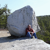
It was, however, cloudy.  A student took this picture of me commenting that it was "Schimmrich in his natural habitat" (on a cloudy cliff with a cup of coffee at the start of the day).  On a clear day from this ledge, you can see all the way to High Point in New Jersey (and beyond).

We started at the Visitor's Center (where I have a video on the geology) and then a quick hike up to Sam's Point.  There we discussed some of the local history (resort hotels, huckleberry pickers, and the old Ice Caves Mountain business).  I also talked more about glaciation in the Hudson Valley since the Shawangunk Ridge is full of glacial erosional and depositional features.

The geology of the Shawangunk Conglomerate was also reviewed (it had been touched upon on Day 4 of the course as well).  From Sam's Point, we hiked to the ice caves (which had no ice in them due to the mild winter).  After lunch, a drive to a nearby park with a roofed pavilion allowed the students to take their final exams without fear of getting their blue books soaked in the rain.

All-in-all it went pretty well (other than the #%@! weather).  It is an exhausting course for me to teach (3 full days, Sunday off, and then 5 full days all outside with a lot of driving and hiking).  After a few beers Friday night with friends I went home and slept for 12 hours!

Tuesday, May 29, 2012

Day 7 - North Lake

On Thursday, May 24, my Geology of the Hudson Valley field course visited North-South Lake - a DEC campground and day-use area.  The weather wasn't too nice, it rained on and off the whole time and there were no views from the Escarpment Trail - just a fog bank.  This photo gives you a flavor of the day.


The area around North Lake has a long and interesting history.  There were once luxury resort hotels here, like the Catskill Mountain House that were haunts of the 19th century rich and famous and are now only a memory.


The Hudson River School of artists also favored the scenic beauty of the area.


Kindred Spirits by Asher Durand (1839) on left and
Kaaterskill Falls by Thomas Cole (1826) on right
(click on images to enlarge)

This area is interesting geologically as well, being in the sedimentary rocks of the Catskill Mountains.  The Catskills are not a true mountain belt - they're composed of undeformed sedimentary rocks - but rather a dissected plateau.

These sedimentary rocks - shales, sandstones, and conglomerates - represent sediments eroded off the ancient Acadian Mountains to the east.  These Himalayan-scale mountains formed when a small microcontinent (Avalonia) collided with what's now the Eastern U.S.  Mountain streams, meandering rivers, floodplains, beaches, and shallow seas of the Catskill Delta system are depositional environments represented by these sedimentary rocks.

To the right is a simple illustration of what the area looked like in the Mid- to Late-Devonian Period.  We were also in a sub-tropical climate zone at the time (about 30 degrees south latitude!).  The best modern analogue is the Ganges Delta of India where streams draining the Himalaya enter the Bay of Bengal.

After a hike along the escarpment trail (where we examined cross-bedded sandstones, puddingstone conglomerates, joint sets, and glacial erratics and striations) to a cloud-shrouded Sunset Rock (famous among the Hudson River School Painters), we chilled for a bit at the top of Kaaterskill Falls (highest in NY State) where cross-bedded sandstones sit atop more easily-eroded redbed shales.


Since we were able to get back to Campus relatively early (due to the cloudy, rainy weather at North Lake), we decided on a quick visit to visit a local cave (Pompey's Cave).  Pompey's Cave is an excellent local example of a karst area with a stream/swamp that seeps down through solution joints into a cave system.  What's left behind is a dry stream bed with a couple of skylights into a cave tunnel about 12 feet under the stream bed in which a stream now flows underground.  The stream exits through a series of springs further downstream.

The dry streambed above Pompey's Cave

The cave is easy to get into with a ladder but the stream in the cave was too high (with rain all week) to safely explore.  We also inadvertently disturbed some people down there (a student knew a couple of them and the person leading the ceremony is a well-known local Native American) who were having a ceremony (burning sage and drumming).  I felt bad about barging in on them like that but we didn't stay long!

Monday, May 28, 2012

Day 6 - Hudson Valley Fold-Thrust Belt

Yes, I got lazy and didn't post after every outing of the Geology of the Hudson Valley field course at the end of each day.  I was just too damn tired in the evenings. It's not like I get paid for this blogging shit.  Because of the lousy intermittent rain, I stopped bringing my camera but, fortunately, some of my students brought theirs and I'll steal their pictures.

Anyway, on Wednesday, May 23, we examined early Devonian rocks from the Helderburg Group up through the Hamilton Group (for those who know what I'm talking about) exposed in the mid-Hudson Valley from Kingston up through Catskill.  These rocks consist of a whole series of limestones above the Taconic angular unconformity and extending upward into more shaly rocks.  They're all marine witnessed by the abundant fossils of marine invertebrates including numerous species of bryozoa, brachiopods, gastropods (snails), trilobites, and corals (all of which we found in these rocks).

The Taconic angular unconformity.  One day I'll write an entire post on
what this represents but for now I'll just say it shows the tilted Late Silurian
Rondout Formation on the left atop the almost-vertical Mid-Ordovician
Austin Glen Group on the right.  Route 23, Catskill.

Even more significantly, these rocks are heavily folded into upward arching anticlines, downward sagging synclines, and cut through with fractures (joints), thrust faults, and mineral-filled veins.  This package of early Devonian rocks in the Hudson Valley have been significantly shortened in a roughly east-west direction.

Hiking on vertically-bedded fossiliferous Becraft Limestone on the Catskill Creek.

These rocks form a small-scale fold-thrust belt (it has folds and thrust faults) that is very well-exposed and easy to study.  Still, generations of geologists haven't really settled one important fact about these rocks - which orogenic event(s) deformed them - Acadian (Devonian) and Alleghanian (Pennsylvanian/Permian) or two different phases of the Alleghanian.

Wednesday, May 23, 2012

Day 5 - Miscellany

On Tuesday, for my Geology of the Hudson Valley field course, we started the day with a 2-hour drive to Saratoga Springs, on the edge of the Adirondacks, where we examined a famous outcrop at Lester Park.  There, on the side of a country road, is a glacially-polished outcrop of Cambrian limestone loaded with exceptional stromatolite fossils.  During the Cambrian Period, around 500 million years ago, the Hudson Valley was a continental shelf environment some 30 degrees or so south of the equator.

From there we worked our way to Thacher State Park, west of Albany.  Thacher is famous for its section of early Devonian limestones exposed along the Helderberg Escarpment.  Unfortunately, it was raining and we didn't have enough time to hike Indian Ladder Trail but we did see examples of many common marine invertebrates, mostly in the rock walls of the park, including different species of brachiopods, bryozoa, crinoid stems, and trilobite fragments.

Finally, we finished up at the New York State Museum to examine their excellent minerals of New York and fossils exhibits.  We were able to see things like minerals from the Hudson Highlands (Day 1), dinosaur tracks from the Newark Basin (Day 2), reconstructions of the stromatolite fossils we viewed at Lester Park that day, and a fossil slab of starfish (Devonaster) and clams from near Saugerties (Wednesdays trip), among many other things.  The best part about the fossil exhibits is that they're laid out divided by geologic time with plate reconstructions showing where the Hudson Valley was during each of these Periods.

Once again, no pictures because even though the forecast was for a 40% chance of rain, it actually rained, sometimes hard, the entire day.

Tuesday, May 22, 2012

Day 4 - The Ordovician & Silurian Periods

Monday, my Geology of the Hudson Valley class examined some Ordovician and Silurian rocks exposed in Ulster County.  No pictures, unfortunately, since it was raining most of the day (pouring in the afternoon).

After the supercontinent of Rodinia rifted apart, this area became a continental shelf with carbonate deposition during the Cambrian and into the Ordovician.  This started to change with the approach of the Taconic Island Arc (see Day 3).

We started down by the Hudson River and examing Ordovician sandstones and shales representing turbidites - relatively deep water shales interbedded with graywacke sandstone submarine landslide deposits.  We looked at some examples of sole marks and graded bedding in the sandstone layers.  These deposits formed as the island arc approached (presumably triggered by earthquakes along the subduction zone associated with the island arc).  The collision of this island arc folded and thrust faulted these shales and sandstones toward what's now the west (we also looked at a couple of faults).  In Ulster County, however, we were far enough from the action that these rocks weren't metamorphosed.

From the River, we drove west to the base of the Shawangunks at the Trapps - a popular rock climbing area known as the Gunks.  There we saw the angular unconformity between the Ordovician shales and the Silurian conglomerate - the Taconic unconformity representing the period of uplift and erosion of the Taconic Mountains.

Over the Shawanungunk Ridge, we stopped at an overlook to the west and spoke about the Rondout Valley where Early Devonian carbonate rocks overlie the older rocks and then grade upward into the sediments of the Catskills.

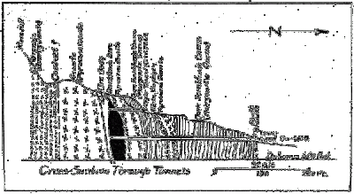
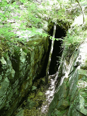
In the Rondout Valley we examined a few more Silurian rock units - the High Falls Shale, Binnewater Sandstone, and Rondout Formation.  The Rondout Formation is the most important of the three since two of its members were mined for natural cement in a narrow belt from Rosendale to Kingston (there's a book there).  After lectures about the Rosendale cement industry and the D&H Canal (they are closely tied together), we visited a couple of mines in the Rosendale and Kingston area.

Again, no images since it was a torrential downpour by the end of the day and we were soaked to the skin by the time we wrapped things up.  There's also a lot more I could write about the geology (and history) of these rocks but it will have to wait - teaching a 9-hour field course every day is tiring!

Sunday, May 20, 2012

Day 3 - Regional Metamorphism

On the third day of the course, we began again in the Hudson Highlands, but on the east side of the river near Bear Mountain Bridge.  We did a short hike and bushwack up from the Appalachian Trail to the Philips Mine.

The mine hasn't been operational since the early 1900's and was primarily exploited for copper, iron, and sulfur (used to make sulfuric acid).  The dominant minerals present were pyrrhotite (basically FeS although it varies a bit), pyrite (FeS2), magnetite (Fe3O4) and chalcopyrite (CuFeS2).

Zodac, P. (1933) The Anthony’s Nose Pyrrhotite Mine. Rocks & Minerals 8(2):61-76

The mine area is a big pile of tailings, sitting in the middle of the woods.  Almost nothing grows on the tailings piles, even 100 years after mining ended, except small white birch trees (evidently tolerant of the sulfur and acidity).  At the top of several terraces of tailings is a deep pit (when you toss a rock down the hole, there are a few bounces and it's a surprisingly large lag of time unil you hear the echoing splash - not some place you want to slip down into).


A bit down the hill is a partially filled-in gated adit (the gate allows bats in and out of the tunnel).


The lower adit, which was covered with rocks and debris, drains groundwater from the mine.  Since the minerals which were mined here are rich is sulfur, the drainage is acidic (2S + 2H2O + 3O2 = 2H2SO4 or sulfuric acid).  Iron is more soluble in acidic water and this drainage leaves behind deposits in various shades of yellow and orange from the iron and sulfur.


With a portable pH meter, I measured the pH of this drainage at 3.0 which is close to the acidity of vinegar.  Not good for plant or animal life in the immediate area.

We did, however, see a coiled up millipede (Narceus annularis?)  I thought was photogenic.


After a quick stop at scenic Indian Brook Falls just south of Cold Spring, we worked our way up into Dutchess County north of I-84.


In Dutchess County we examined the Poughquog Quartzite, the Wappingers Group carbonates, and various schists and phyllites.  The story behind these rocks is long but here's a brief summary...

As I mentioned in my Day 1 post, the supercontinent of Rodinia formed by the collision of Laurentia (proto-North America) and Amazonia between 1.3-1.1 billion years ago.  This event, called the Grenville Orogeny formed Himalayan-scale mountains.  Over the next few hundred million years, these mountains eroded away.  High-grade metamorphic rock, which formed 10-12 miles down in the crust, became the exposed bedrock of New York State (long before any life existed on land).

Rodinia eventually broke apart, Amazonia drifted away (late Proterozoic Eon), and the Hudson Valley area became a continental shelf environment of warm, shallow seawater (Cambrian Period).  First sands, then carbonate mud, and then clay muds and sands when the area became a deeper basin with the approach of a volcanic island arc (Ordovician Period).  The island arc eventually collided resulting in Rockies-scale mountains, widespread metamorphism, and faulting and folding of these Cambro-Ordovician rocks.  This was called the Taconic Orogeny.

The Poughquog Sandstone, the Wappingers Group carbonates, and various schists and phyllites are what formed in this environment.  The Wappingers Group in Dutchess County, north of the Hudson Highlands, correlates with the Inwood Marble we saw on Day 2 down in Manhattan.  The difference being that the Inwood Marble is more metamorphosed because it was closer to the Taconic mountain belt.  The various schists and phyllites we saw in Dutchess County correlate with the Manhattan Formation exposed throughout the island of Manhattan (ever sit on rock outcrops in Central Park?).

The schists and phyllites represent grades of metamorphism.  To the east, toward the Connecticut border, the schists have higher temperature and pressure minerals than to the west, toward the Hudson River (regional metamorphism).  When you cross the Hudson into Ulster County, you're far enough from the Taconic mountain belt that the rocks are still sedimentary (although still heavily folded and faulted).

A break for Sunday and then on to the west side of the river on Monday.

Saturday, May 19, 2012

Day 2 - Newark Basin & Manhattan Prong

Today we began at the southern side of the Hudson Highlands in Suffern, NY and then crossed the Ramapo Fault (there are places you can put your hand on it) into the Newark Basin.


The Newark Basin, that little bit of pinkish-red in the map above, is mostly in New Jersey but represents a rift basin formed by the breakup of Pangaea during the Triassic Period.  After the rift a little further to the east broke though, eventually forming the Atlantic Ocean, Africa drifted away from North America and the Newark basin stopped spreading.


A thick pile of sediments accumulated within this basin (along with intrusions of igneous rock like the Palisades Sill).  See the red units labeld fanglomerate?


Here's an example near Suffern (and close to the Ramapo Fault).  This redbed conglomerate consists of rounded cobbles (of Hudson Highlands gneiss) cemented together with quartz and potassium feldspar grains of sand-sized sediments.  It formed as an alluvial fan on the edge of theNewark Basin some 200 million years ago (the greenery is poison ivy).


From there we drove down the Palisades Parkway to the State Line Lookout rest area to view the exposed rocks of the Palisades Sill on the west side of the Hudson.


Turns out that last Saturday, a rather large section of the cliff broke off and collapsed right near where we were (you can see the State Line parking lot in the image below).


A Fox Five news team showed up when we were there and they asked to interview me when they saw I was lecturing to students about geology.


My segment was never aired (guess I'm not pretty enough for TV).  When she asked if I was surprised to learn that a segment of the cliff collapsed, I said something like "No, not really. To a geologist it's expected that segments of the jointed cliff face weather and collapse occassionally."  Check out the story here.

We then drove across the George Washington Bridge and looked at the Manhattan Formation and Inwood Marble in Washington Heights and then went up to Van Cortlandt Park in the Bronx to see the Fordham Gneiss.  Had to love all the little tiny empty baggies on the ground in Inwood Hill Park (once containing crack rocks, I assume).

I'll write more about the geology tomorrow. 

Then it was a slow ride back across the Tappan Zee (Friday at 4 pm traffic) and back home.

Friday, May 18, 2012

Day 1 - Hudson Highlands

Today was the first day of my Geology of the Hudson Valley field course.  After a quick orientation in the classroom, we drove down to the top of Bear Mountain in Harriman State Park.  Once there, I lectured for a bit on the outcrop, providing the students with an introduction to geologic time and plate tectonics.

The Highlands, which run from the NY/CT border southwestward into NJ and then PA, represent some of the oldest rocks in NY State.  They are essentially the same as the rocks up in the Adirondacks and, actually represent the deep basement rocks under all of NY (outside of the Highlands and the Adirondacks, they're covered by thousands of feet of younger sedimentary rocks).  They're exposed in the Highlands and Adirondacks because they've been uplifted through the younger cover rocks.


The Highlands are the region with Middle Proterozoic rocks in southeastern New York in the map above.  If you've ever been to Bear Mountain, Harriman State Park, or West Point, you've been in the Highlands.

The rocks that underlie all of NY represent a mountain building event (orogeny) which took place between 1.3 and 1.1 billion years ago - the Grenville Orogeny.  It was caused by a collision between proto-North America (called Laurentia) by geologists and another small block of continental crust - possibly Amazonia (which is now part of South America).  Just like India colliding with Asia in recent geologic time, forming the Himalaya, this ancient collision formed Himalayan-scale mountains along what's now the eastern seaboard.


The rocks we looked at at Bear Mountain, and a few other places in the Highlands, were all different types of gneiss - a high-grade metamorphic rocks formed deep within the core of the ancient Grenville Mountains (some 12 miles below the surface). We also saw a couple of granitic intrusions.

After discussing the Grenville Orogeny we climbed the tower and took in the view - it was clear enough to see the buildings of Manhattan and I could pick out the Empire State building and the new Freedom Tower downtown.  We also looked at some glacial chattermarks covering many of the exposed granitic gneiss outcrops.


Then we drove to an overlook of the Hudson and talked briefly about the role of the geology in controlling the course and characteristics of the Hudson as if flows through this area (it's much narrower here than it is further north or south because of the harder and more resistent rocks).  The Highlands are also rich in history - especially from the Revolutionary War when the area was strategically important to both the British and the colonists.

After a brown bag lunch on an outcrop, we drove down down Seven Lakes Drive to a parking area by Lakes Askoti and Skannatati.  From there we hiked the Long Path out to the Hogencamp and Pine Swamp iron mines (it was about a 4 mile round-trip hike).  Veins of magnetite (Fe3O4) iron ore were mined in the Highlands from the 1700s and the entire area is dotted with small mines (mostly flooded now) and remains of furnaces, forges, and abandoned towns.


These magnetite deposits formed around 900 million years ago from hot iron-rich fluids circulating through faults and fractures deep within the Grenville Mountains.  Overgrown hills of tailings still contain lots of nice pieces of magnetite (no collecting allowed from State Parks, however).

Unfortunately, the one downside to the day were the ticks that kept appearing on people (I took one off my leg before showering at home that night).  I really hate ticks.

Tomorrow, down to the City.

Tuesday, May 15, 2012

Geology of the Hudson Valley

Thursday, May 17 starts my eight-day field course on the Geology of the Hudson Valley.  It's one of my favorite courses to teach - it's entirely outdoors, all day, looking at rocks (and other geologic features) from New York City to Albany.

I will try to blog each evening about what we did that day and see how it goes...

Monday, May 14, 2012

Random stuff...

The spring semester ended today.  It was the last day of finals, everything is graded, and now I switch gears for my summer field course (starting Thursday!).

Some things that have puzzled, annoyed, or amused me these past few days...

- Students who plagiarize a final paper, even when I require them to submit it TurnItIn before handing it in and I provide them with multiple documents warning them against plagiarism.  He turned it in even though TurnItIn said it was 36% plagiarized.  I suppose the student hoped I was too stupid to notice substantial portions of text, without quotations, directly lifted from an online Encyclopedia of Science.  TurnItIn even provided me with the link to where the material was lifted.  That paper was easy to grade.

- Students who tell me they didn't know the time and date a final exam was due in an online class even though there was a banner in the announcements, a statement in the weekly checklist document, a post in the weekly discussion board, and an email sent directly to all students ALL stating, in BOLD-FACED, CAPITALIZED, RED TEXT that the final had to be submitted by Friday, May 11 at 12 noon.  Good God, what more can I do besides hold the sides of their head and yell it into their faces!

- The astonishingly poor quality of many of the final papers received in one of my classes.  We added a freshman English corequisite to this course specifically for this reason but it doesn't seem to have helped.  While some students did a great job, and wrote papers which were interesting and enjoyable to read, many others submitted papers that barely reached an 8th grade level in terms of grammar, coherence, and quality.  And really, how hard is it to use apostrophe's correctly?  And what's up with the random Capitalization of words. [Yes, those two errors were intentional!].

- Faculty who don't turn things in (like grades or attendance records) and make people like me (department chairs) chase them down to ask them to do their damn job.  Come one!  Gotta love being a department chair - we have all this responsibility but no power to get people to do anything other than by pleading.  It's routine to get an email from some area of the college saying professor so-and-so didn't do something they were supposed to do and I am expected to address it.  Problem is I have no power to get professor so-and-so to do anything.  They have tenure.  They tell me they're busy (so is everyone else dipshit).  I have nothing to give them and no method of punishing them (no carrots and no sticks).  Yes, I volunteered to do this job.  Yes, I am fucking stupid.

- So I subscribe to something called Pixel of Ink.  It's a daily email listing free Kindle books you can grab from Amazon.  As I was reading the mailing today, I couldn't stop laughing.  Here's an actual description (comma errors intact) of a book (Written in the Sky: Rise of the Wadjet Witch): "All, future astronomer, Memphis Holland wanted was to quit smoking. The pressure to complete her dissertation on Ophiuchus the lost astrological sign and receive her PhD in Astrophysics has been high. She visits a hypnotherapist to rid her of her cravings and instead is given the ability to see the future and to teleport."  Yeah, astrophysicists write dissertations on astrological constellations!   Free is too expensive for this one.

- We're looking for a chemistry adjunct and a remedial math adjunct where I'm teaching.  We received a dozen resumes for the remedial math position and none for the chemistry.  I guess I understand why but it will be a problem if we can't find someone to teach General Chemistry II next fall!

- Read something recently that cracked me up.  A not-nice guy (Tucker Max) was talking to a particularly vapid girl in a bar and suddenly blurted out "You are making me stupider."  Ever wanted to say that to someone who was talking to you?

- Been depressed lately and feeling like no one likes me.  Probably because I'm such a grumpy bastard.  I do look forward, however, to my eight-day field course (I will post more about this in a couple of days).  Students in the course are generally interested in geology and motivated.  I get to hike around with them all day looking at rocks.  That's a good way to spend a couple of weeks.  Rocks are so much more interesting than many people I know.  Rocks also don't mind being around me unlike many people I know.

Thursday, May 10, 2012

We should ban chemicals...

A couple of things I found on the web...


Look, they're both "Chemical Free".

Check this shit out...


And afterwards, your chemical-free kids can go play in the chemical-free park...


If I have to explain why these are incredibly stupid, I can do so over dinner.  I'll prepare my "to-die-for" all-natural, hand-harvested, organic mushrooms...

Monday, May 7, 2012

Every Major's Terrible

I love this XKCD webcomic - Every Major's Terrible (To the Tune of Gilbert & Sullivan's Modern Major General).  It's all true!

I love the philosophy one (at left).  Two plus lightbulb equals sailboat is a pretty good summary of modern philosophy, isn't it?

Sunday, May 6, 2012

"Supermoon" Nonsense

Last night, the Moon was full (as it is every 29.5 days).  It was 356,953 kilometers from Earth.  Since the Moon orbits the Earth in an ellipse, it also happens to also be the closest full Moon approach of the year (called perigee).  Last month's full Moon was around April 7 and it was 358,313 km away (here's an apogee and perigee calculator).

For some bizarre reason, the news media has taken to calling these events "Supermoons" and there have been a spate of "news" stories about this the past couple of days.  "Supermoon" is a mostly bullshit term which I believe was first proposed by an astrologer named Richard Nolle.  I say mostly bullshit because it is grounded in real astronomy (the orbit and phases of the Moon) but attributes special qualities to a Moon that's at perigee when it's full (there's the bullshit part).

I wrote about this supermoon crap in March 2011 as well.

I recently had a post on calculating the size of the Sun in the sky where I showed how to derive a formula for calculating how large an astronomical body appears in the sky.  Works for the Moon as well as the Sun.  The formula is:

     d = 2 tan-1 [(D/2)/d]

where D is the diameter of the Moon, d is the distance from the Earth to the Moon, and delta (d) is the angular size of the Moon in the sky.  The mean diameter of the Moon is 3,476 km.  The distances are listed above.  Let's calculate the difference in the "super" Moon's angular diameter versus last month's Moon.

"Super" Moon:

     d = 2 tan-1 [(D/2)/d] = 2 tan-1 [(3,476 km/2)/356,953 km] =0.558°

"Regular" Moon:

     d = 2 tan-1 [(D/2)/d] = 2 tan-1 [(3,476 km/2)/358,313 km] = 0.556°

That's a difference of 0.4% when looking at the Moon in the night sky.  Here is this difference shown to scale:


Not very impressive, is it?  And this is NOT how large the full Moon appears in the sky.  Go outside anytime the Moon is full, outstretch your arm and extend your pinkie finger.  The fingernail on your pinkie finger will easily cover the Moon.

Not that I'm denigrating the Moon.  I love the Moon in all its phases and am always looking up (even during the daytime) to see if I can spot it and know where it is in its cycle of phases.  I always encourage people to go out and look up.  But there's nothing astronomically special about this weekend's full Moon.

Tuesday, May 1, 2012

End of Semester Blues

How can you tell it's the end of the semester?

I have lots and lots of papers to read and grade.


By the way, for those who take things way to damn seriously, it's a joke picture.  I don't drink while I grade, I drink after I grade.  I also don't drink vodka (I think my wife polished up that bottle).

Yes, that is a real pile of final reports for a class I teach - about a ream of paper's worth.  Time to break out a new red pen.