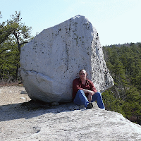
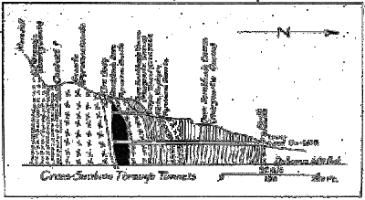
The mine hasn't been operational since the early 1900's and was primarily exploited for copper, iron, and sulfur (used to make sulfuric acid). The dominant minerals present were pyrrhotite (basically FeS although it varies a bit), pyrite (FeS2), magnetite (Fe3O4) and chalcopyrite (CuFeS2).
Zodac, P. (1933) The Anthony’s Nose Pyrrhotite Mine. Rocks & Minerals 8(2):61-76
A bit down the hill is a partially filled-in gated adit (the gate allows bats in and out of the tunnel).
The lower adit, which was covered with rocks and debris, drains groundwater from the mine. Since the minerals which were mined here are rich is sulfur, the drainage is acidic (2S + 2H2O + 3O2 = 2H2SO4 or sulfuric acid). Iron is more soluble in acidic water and this drainage leaves behind deposits in various shades of yellow and orange from the iron and sulfur.
With a portable pH meter, I measured the pH of this drainage at 3.0 which is close to the acidity of vinegar. Not good for plant or animal life in the immediate area.
We did, however, see a coiled up millipede (Narceus annularis?) I thought was photogenic.
After a quick stop at scenic Indian Brook Falls just south of Cold Spring, we worked our way up into Dutchess County north of I-84.
In Dutchess County we examined the Poughquog Quartzite, the Wappingers Group carbonates, and various schists and phyllites. The story behind these rocks is long but here's a brief summary...
As I mentioned in my Day 1 post, the supercontinent of Rodinia formed by the collision of Laurentia (proto-North America) and Amazonia between 1.3-1.1 billion years ago. This event, called the Grenville Orogeny formed Himalayan-scale mountains. Over the next few hundred million years, these mountains eroded away. High-grade metamorphic rock, which formed 10-12 miles down in the crust, became the exposed bedrock of New York State (long before any life existed on land).
 Rodinia eventually broke apart, Amazonia drifted away (late Proterozoic Eon), and the Hudson Valley area became a continental shelf environment of warm, shallow seawater (Cambrian Period). First sands, then carbonate mud, and then clay muds and sands when the area became a deeper basin with the approach of a volcanic island arc (Ordovician Period). The island arc eventually collided resulting in Rockies-scale mountains, widespread metamorphism, and faulting and folding of these Cambro-Ordovician rocks. This was called the Taconic Orogeny.
The Poughquog Sandstone, the Wappingers Group carbonates, and various schists and phyllites are what formed in this environment. The Wappingers Group in Dutchess County, north of the Hudson Highlands, correlates with the Inwood Marble we saw on Day 2 down in Manhattan. The difference being that the Inwood Marble is more metamorphosed because it was closer to the Taconic mountain belt. The various schists and phyllites we saw in Dutchess County correlate with the Manhattan Formation exposed throughout the island of Manhattan (ever sit on rock outcrops in Central Park?).
The schists and phyllites represent grades of metamorphism. To the east, toward the Connecticut border, the schists have higher temperature and pressure minerals than to the west, toward the Hudson River (regional metamorphism). When you cross the Hudson into Ulster County, you're far enough from the Taconic mountain belt that the rocks are still sedimentary (although still heavily folded and faulted).
A break for Sunday and then on to the west side of the river on Monday.


No comments:
Post a Comment