


 Unique Visitors
This post is about an area a little far afield from the Hudson Valley but about a geologically significant area - it's featured in the lab manual I use for my Physical Geology course at SUNY Ulster. It's about a place I visited on vacation a couple of years ago.
Wallace Creek is on the Carizzo Plain halfway between Los Angeles and San Francisco, east of the Coast Range, and in a dry, arid desert environment. I drove 7 miles or so down a dirt road to get there. (why I own an all-wheel drive vehicle with high clearance!).
What makes Wallace Creek so interesting is that it crosses the San Andreas Fault - the boundary between the North American tectonic plate and the Pacific tectonic plate. The Pacific Plate is trying to move northwards with respect to the North American Plate and, after stresses build up for a while, it eventually slips along one segment or another generating an earthquake (sometimes a large one).
On January 9, 1857, this segment of the fault actually moved 6 meters (20 feet or so) during the 7.9 magnitude Fort Tejon earthquake. As the fault moves over the years (centuries), the creek has become offset where it crosses the fault clearly showing the direction and magnitude of movement.
Here's a nice aerial view of the offset.

This view is looking south. On the left is the North American Plate and on the right is the Pacific Plate. You can clearly see the offset of Wallace Creek in the center of the photo with the Pacific Plate moving north (toward the bottom of the photo). The fault scarp of the San Andreas is clearly visible.
What's it look like on the ground? Below is the interpretive sign at the parking area.

Here's a look back to the parking area (two black dots) from the creek. My wife and stepson stayed in the car with the AC running because it was around 100 degrees F (the Hudson Valley Geologist is made of sterner stuff and will suffer for geology). The white in the distance is a soda (alkaline) lake bed. The path to the left follows the fault scarp of the San Andreas Fault.

The feature is a bit difficult to see from a ground picture, but the creek is running away from me here (it's dry but marked by the greenery in the ditch). In the distance it bends left (onto the Pacific Plate) and in the foreground where I'm standing it turns right onto the North American Plate (off the picture). Looking straight ahead (north) is looking along the axis of the San Andreas Plate.

After visiting Wallace Creek, we stopped at the Parkfield-Coalinga Bridge across Little Cholame Creek for a photo op. The bridge literally crosses the San Andreas Fault.
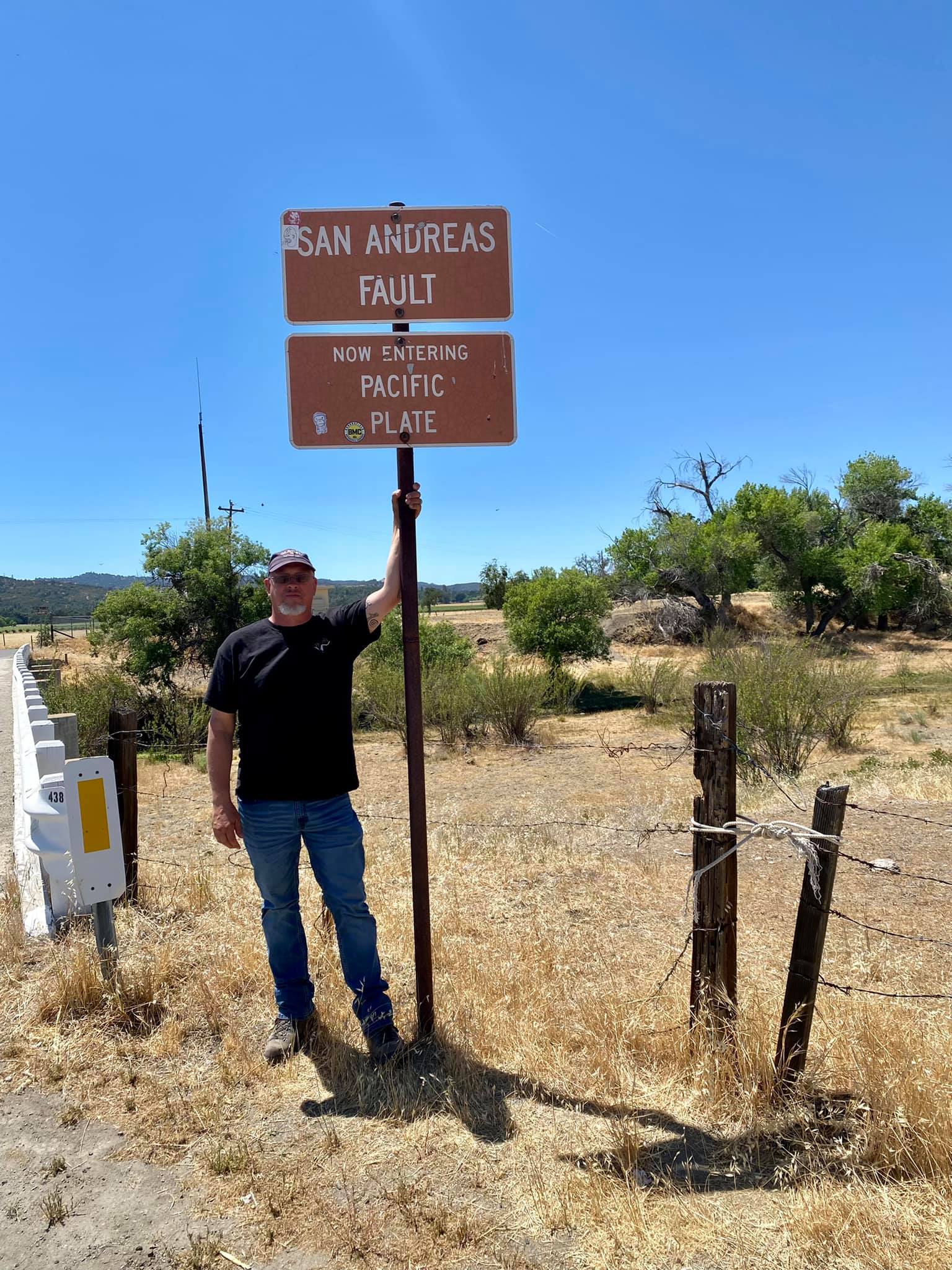

I was so excited I couldn't resist a little pole dancing here (I'll keep by day job).
No comments:
Post a Comment