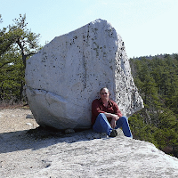
I went with Ray Haberski, a former school principal and educator who hikes up there each year around the 4th and knows the way. We started off Berme Road near the J&M Originals factory and bushwacked up to the Old Minnewaska Road carriageway. A short distance up the carriageway and then we bushwacked up the hill to the start of the ice cave system.
It starts with what looks like a small fracture, but when you crawl into it the fracture opens up into a major crevice a few feet wide and over 50 feet high. The sides of the walls show clear signs of having been a strike-slip fault system with fault striations and polishing (slickensides).
These large strike-slip faults, perpendicular to the fold axes of the ridge, are common. These have evidently cut down into the underlying shale allowing the Shawangunk Conglomerate to slide a bit downslope opening up these relatively large crevice systems.
Inside the first large crevice was a substantial pile of breakdown which seemed very fresh (perhaps this previous winter/spring). It is disconcerting to look at the walls in some places in the ice caves and to see how unstable some of the rocks appear.
Another view of the crevice.
Here's the view straight up...
After climbing out of the first major crevice, we were on some slabs with pitch pines and views of Ellenville. Then we viewed a few more crevices and deep holes with icy cold air coming out of them but there was no easy way to explore them (one could get in, getting out would be the problem).
The next major crevice system we traversed through had an actual talus cave (Ray told me there were others around as well but we didn't visit them). This one handily had a ladder to descend into it was was quite large inside (and dark, you need flashlights). Note also the graffiti - I hope I never find anyone writing on rock walls in beautiful, unique places like this because I'd be sorely tempted to do violence upon them.
The climb out of the crevice was a bit more challenging involving wet, slippery, moss-covered rocks tilted the wrong way. A slip and fall would leave you in bad shape in a place where rescue would be a long time coming.
We eventually reached a high point (climbing an estimated 1,300 feet in elevation from our cars by my estimation) where we came to the Grand Canyon where a crevice had widened into a true canyon between sheer cliff walls.
We descended into the Grand Canyon and hiked through it. There are a number of unusual plant species down there and thick pads of mosses.
It's a unique ecosystem for the area which exists because temperatures in the depths are much cooler than above. On the canyon rim, it was 90+ degrees with strong sunlight and at the bottom you could have worn a jacket and it was shady most of the day. Here and there were small patches of snow and ice but not as much as normal due to our very warm spring.
After the Grand Canyon, we bushwacked across to another, slightly smaller canyon which came out at the top of Shingle Gulley. We followed the gulley back down to the Old Minnewaska Road and then bushwacked down to our cars (which was rough going and left me with scratched up arms).


Did you ever find the GPS coordinates for the Shingle Gully ice caves?
ReplyDeleteMy son and I are exploring up from Bearme Road park and we haven't been able to locate the ice caves. From Bearme Road parking lot do we take the trail to the left which goes towards the old spring water bottling plant and then go straight up from there?
You know I never got back up there last year. I'll try again this summer (June, most likely). I think the easiest way is off Old Minnewaska Road up Shingle Gully but it's real tricky unless you've been there before.
ReplyDelete