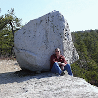
I took this picture during the summer from a location called Cope's Lookout on the Mohonk Mountain House property. Mohonk Mountain House is a beautiful (albeit expensive) resort located on the Shawangunk Ridge in the mid-Hudson Valley.
The Shawangunks (locally pronounced "shon-gums") is a NE-SW trending ridge arising in Rosendale (Ulster County) and running past Port Jervis into NJ/PA on the east side of the Delaware River. On the east side of the Shawangunks is the Wallkill and Hudson River Valleys and on the west side is the Rondout Valley and Catskills. The geology of the Shawangunks is interesting but I'll save that for another post - suffice to say that it's composed of rock (Shawangunk Conglomerate) of a different age than the rocks underlying the valleys on either side of the Ridge.
This view from Cope's Lookout is facing roughly SW along the Ridge. On the left, a bit of the Wallkill and Hudson Valleys can be seen to the SE. On the east side of the ridge are cliffs popular among rock climbers (the "gunks" are actually world-famous for rock climbing). The land surface slopes downward from the tops of these cliffs into Clove Valley in the center of the image. On the other side of Clove Valley, the ground rises up again. The reason Clove Valley exists is because the Shawangunk Conglomerate underlying this valley is folded into a syncline - a downward-sagging fold. Imagine holding a flat sheet of paper between your two hands and pushing your hands toward each other until the sheet of paper buckles downward into a U-shape - the beds of Shawangunk Conglomerate did the same thing here.
Hiking on the rocks on the east (left) side of Clove Valley shows that the layers (beds) of rock are dipping downward toward the west (into Clove Valley). Hiking on the rocks on the west (right) side of Clove Valley shows that the beds of rock are dipping downward toward the east (also into Clove Valley). It's actually possible to hike throughout most of the area visible in this image because the land is owned by the Mohonk Preserve and accessible after paying an entrance fee or having a membership (highly recommended if you live in the area). The land in the distance is part of Lake Minnewaska State Park (also highly recommended for a visit).
Below is a cross-section of the geology of the mid-Hudson Valley from Regional Geology of Southeastern New York State for Teachers and Travelers by J. Bret Bennington of Hofstra University.
See where it says Lake Minnewaska? That's the top of the Shawangunk Ridge and the layer of rock with dots in it is the Shawangunk Conglomerate. Note how it's a bit "wavy" where it's exposed at the surface? Those are folds and one of the downward warps (a syncline in geology) is the Clove Valley! The Shawangunk Ridge is exposed where it is due to a combination of folding and the fact that it's a harder, more resistant rock than the shales under the Wallkill Valley to the east and the limestones (primarily) under the Rondout Valley to the west. The great glacial ice sheets moving down the Hudson Valley during the last ice age (which ended just a few thousand years ago) also played a huge role in shaping the landscape we see today.
The underlying geology obviously affects the present-day shape of the landscape. The geologic history (e.g. glaciation) also clearly affects the present-day shape of the landscape. But, less obviously, the underlying geology can also affect the flora and fauna of the region. I'll discuss the unique ecosystems present on the Shawangunk Ridge at a later date.


No comments:
Post a Comment