Friday, December 30, 2011

The 1700 Cascadia Quake

Since I just reviewed Jerry Thompson's Cascadia's Fault book, I thought I'd also say a few words about the massive earthquake which occurred on the Cascadia subduction zone back in 1700.  Before we do that, let me just remind everyone what a magnitude 9.0 earthquake is like when it occurs on a subducting plate under the seafloor.

On March 11 of this year, an earthquake of this magnitude occurred beneath the ocean floor 43 miles east of the Oshika Peninsula of Japan.  The quake and resultant tsunami killed over 15,000 people and resulted in an economic cost of over 200 billion US dollars.


On December 26, 2004, a similar type of earthquake occurred just off the west coast of Sumatra in Indonesia.  The resultant tsunami killed over 200,000 people around the Indian Ocean and caused tens of billions of dollars in damage.


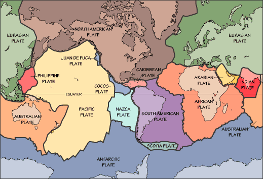
Similarly large earthquakes have occurred along offshore subduction zones in 1985 in Mexico, 1964 in Alaska, and 1960 in Chile.  They're not especially uncommon.

Queule, Chile, before and after the 1960 earthquake and tsunami

In the late 1980s and through the 1990s, researchers like USGS geologist Brian Atwater started noticing evidence for a very large earthquake along the Pacific Northwest coast.  Groves of trees were found submerged into salt water and killed when the land suddenly subsided.  Radiocarbon dating and studies of growth rings in the trees narrowed the time of the earthquake to around 1700. 

Submerged cedar forest - Willapa Bay, Washington

A connection was then made to historical records of a tsunami striking numerous villages in Japan on January 27, 1700 (leading to a date of the earthquake of January 26).

Painting of 1854 Hiro Village, Japan tsunami

Pacific Northwest native peoples also had legends of a large earthquake and tsunami (although not specifying a date).  Many of the stories are wrapped in stories of battles between mythological creatures like Thunderbird and Whale. 

Here's one matter-of-fact account from at 1864 diary entry by James Swan, the first schoolteacher on the Makah reservation at Neah Bay near the Straits of Juan de Fuca...

Billy also related an interesting tradition. He says that "ankarty" but not "Irias ankarty" that is at not a very remote period the water flowed from Neah Bay through the Waatch prairie, and Cape Flattery was an Island. That the water receded and left Neah Bay dry for four days and became very warm. It then rose again without any swell or waves and submerged the whole of the cape and in fact the whole country except the mountains back of Clyoquot. As the water rose those who had canoes put their effects into them and floated off with the current which set strong to the north. Some drifted one way and some another and when the waters again resumed their accustomed level a portion of the tribe found themselves beyond Noothu where their descendants now reside and are known by the same name as the Makah or Quinaitchechat. Many canoes came down in the trees and were destroyed and numerous lives were lost. The same thing happened at Quillehuyte and a portion of that tribe went off either in canoes or by land and found the Chimahcum tribe at Port Townsend.

Now let's review the following image from my previous post.


See that red dot labeled "Subduction zone earthquake (1700)"?  Can a magnitude 9+ earthquake and resultant tsunami happen again along this subduction zone?  Absolutely!  Large sections of this megathrust fault have been basically locked for 300 years or so and there is a chance that it will let go in our lifetimes.

A piece of advice... If you're on a Pacific Northwestern beach or live in a low-lying area, and you feel a large quake with prolonged shaking, run, don't walk, to higher ground!

Wednesday, December 28, 2011

Cascadia's Fault - Part 2

Finishing my review of Cascadia's Fault by Jerry Thompson.  Read yesterday's post if you haven't already and then come back here...

My last post illustrates the biggest problem with the book - not one diagram of the Cascadia subductions zone.  Not one map.  Not one cross-section.  The purpose of the book is to make the public “sit up, pay attention, and get ready” yet non-geologists will simply not understand the geological explanations Thompson provides.  It would have been trivially easy to include these illustrations, and Thompson does provide a few pictures of historical earthquakes, like the 1964 Good Friday quake in Alaska, so it's puzzling why he didn't do so.

One strength of the book is the historical background but even this comes with a caveat.  Geologists began recognizing the danger of the Cascadia subduction zone around the time the modern theory of plate tectonics was being developed.  It was an exciting, and sometimes acrimonious, time in geology.  Thompson covers this historical development in detail, almost too much detail at times, yet fails to capture this excitement.  I honestly found much of the central part of this book to be tedious reading and started skimming even though I should have been interested.

Finally, the book was a bit sensationalistic (Thompson was trained as a journalist and he wants to sell documentaries).  The subtitle "the coming earthquake and tsunami that could devastate North America" is a bit overblown and the last part of the book is an absolute worst-case scenario of what could happen if a major earthqauke occurred along this fault zone.

So, bottom line, I can't recommend this book that much but it is an important issue and an interesting geologic feature which could cause great devastation when it lets go some day.  If you're still interested in reading it, borrow the book from the library like I did.

Tuesday, December 27, 2011

Cascadia's Fault

I recently read Cascadia's Fault: The Coming Earthquake and Tsunami that Could Devastate North America by Jerry Thompson (Counterpoint, 2012).

Thompson is a documentary filmmaker living outside of Vancouver in British Columbia who's produced and narrated several television documentaries on the Cascadia fault for the CBC.  Thompson's interest in the Cascadia subduction zone was due, in large part, to his home being located in an area that might be directly affected by a large earthquake along that fault zone.

I have to confess that I wanted to like this book, but I'm afraid I didn't.  First a little background...

I don't believe regular readers of this blog need much of an introduction to plate tectonics. The Earth's rigid outer shell, called the lithosphere, is split into a number of tectonic plates which all move relative to one another.  Virtually all of the continental United States and Canada, with the exception of a small sliver of southern California, is sitting on the North American Plate.


Just offshore of the Pacific Northwest (Northern California, Oregon, and Washington) is a small plate of oceanic crust called the Juan de Fuca Plate.

Since I love tangential stories, I'll share the following.  Juan de Fuca was a Greek navigator (Ioánnis Fokás) who sailed for Spain to look for the fabled Strait of Anián, a supposed Northwest Passage across the top of North America, and claimed to have discovered it in 1592.  The English captain, Charles William Barkley named the Juan de Fuca Strait in 1787 in his honor believing that's what Juan de Fuca described from his voyage almost 200 years earlier.

Anyway, here's a closer view of the region.  The north-south purple barbed line just off the coast of the Pacific Northwest is the Cascadia Subduction Zone - the trench down which the Juan de Fuca plate subducts as it pushes eastward, away from newly-forming ocean crust at the Juan de Fuca and Gorda Ridges, and as the North American Plate moves westward away from the distant mid-Atlantic Ridge on the opposite side of the continent.


Here's an oblique-view of the region showing the subduction of the Juan de Fuca Plate down the Cascadia Subduction Zone beneath North America.


Melting of the subducting plate provides magma for the Pacific Northwest chain of volcanoes comprising the Cascades Range.  Mount Lassen, Mount Shasta, Crater Lake, Mount Hood, Mount St Helens, Mount Rainier, and others have all erupted in historic times and will all erupt again (many people living in the shadows of these beautiful mountains are in a state of deep denial about that fact).

Subduction zones are also the locations of some of the largest and most destructive earthquakes on Earth.  So, while the San Andreas Fault is the one in the public's consciousness, the Cascadia Fault is potentially just as deadly (if not more so).

Let me just add that if Thompson, the author of Cascadia's Fault, had given a background like I did above, with drawings of the plates and subduction zone, I would have reviewed his book much higher than I will tomorrow, when I finish this discussion!

Monday, December 26, 2011

Gastroenteritis for Christmas

One of the downsides of being the parent of young children is that they occassionally get sick.  Then they make you sick.  My 10-year-old son picked up a stomach virus last week and gave it to me just in time to have a low-grade fever all day on Christmas Eve and unable to enjoy all the good food and beverages on Christmas Day (a turkey dinner with all the fixings at my house).

On the positive side, The worst of it is only 24 hours and it's mostly gone after a couple of days.  I also lost a couple of pounds over Christmas weekend rather than gaining weight as I normally would have done!

I've been feeling bad about not keeping the blog active lately but really stressed over the last few weeks of the semester.  Hopefully, things will be back to normal (relatively, at least) soon.  I've been reading some interesting books lately on geology and hope to share some of that this week.